This is a song of my parent's generation, dating to a time when Canada's interaction with Newfoundland and Labrador was rather more offensively colonialist than it is now. The version, or perhaps phantasm, that sticks in my mind from those days is rather different from that of Great Big Sea. According to errant memory, it borrows some of the lyrics of "Spanish Ladies," as well as the tune. (Not that I can find a version of "Spanish Ladies" on Youtube, either.)
Let's just imagine someone, somewhere, singing about a "true Newfoundlander's" voyage ending when he struck soundings off Penzance. Because there was a time when the Newfoundland fleet did aim for the mouth of the channel, and find it, and journey's end, by feeling their way across the shoaling European continental shelf with lead and sinker. That's an old time sailor, with a map of the geography of the sea in his head, of plains of gravel and sand, of dangerous shoals --and a vast wilderness, where the leadsman shouts, "No bottom!"
This wilderness.
Medieval churchmen, of a certain breed, sought God in the wilderness. It's a search that is a great deal easier to prosecute with places to stop. That's a point often made of Saint Brendan's voyages to the Isles of the Blessed, and is an insight that could be applied more closely to both the story of Vinland and early accounts of Plymouth Colony.
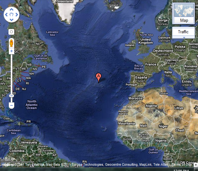
This is supposed to be Google Maps satellite view of actual islands in the wilderness. Actually, I've zoomed out far enough that it's pretty much a Mercator perspective. An actual satellite view doesn't tell us very much. There the Azores are, covering a great deal of sea in extent (600 km northwest by southeast), if not land area (2306 km2), but still out there, all alone. They are not closer than 1500km from the nearest European landfall, in Portugal. The Wikipedia article implies that they are even further from the American continent. The westernmost point in the archipelago, it suggests, is 3880 km from the New World.
This isn't true, although the Mercadian distortion makes it very difficult to see it. The capital of the 205 square-kilometre northwesternmost island of the Azores, Flores, is at 39° 27′ 18″ N, 31° 7′ 53″ W. Cape Farewell, Greenland, is at 59° 46′ 23″ N, 43° 55′ 21″ W; St. John's, Newfoundland, is at 47° 34′ 3″ N, 52° 42′ 26″ W; and Sable Island, Nova Scotia, is at 43° 57′ 0″ N, 59° 54′ 57″ W. I'd plug these coordinates into a Great Circle Distance calculator for you, but the one I found is giving me those old unhelpful-error-message-make-me-scream-at-the-screen-in-rage blues. Let's just say that it's about 2200km from Saint John's, and let it go at that. The American continent runs southwest-by-northeast, and on the right course, the Azores are half way to the New World.
Parry's "leapfrog" argument is that the Atlantic islands presented themselves to the Portuguese as a series of highly lucrative settlement opportunities. The intersection of politics and trade explains why Portugal jumped into the business in the middle years of the 1400s, and the broad implication is that a self-reinforcing cycle of investment-return-investment explains why they continued in it. Depending on whose claim we take seriously, the sea of business might have begun to wash up on Flores as early as 1451, but we find Columbus' future mother-in-law subletting the island to a Flemish entrepeneur in 1479 in contemporary documents that provide us with a more certain historical starting point.
After all, this version has Columbus in it. We're getting to the New World now, for sure. And we're already half way! Isn't this the logical place from which to discover the Americas?
The traditional sailor's explanation for what happens next is that the winds were wrong. And while sailors can be unreliable witnesses, prone to confabulation in the service of a good story, they aren't wrong about this. Columbus eventually set out from the Canaries (or succeeded because he set out from the Canaries) with a commission from the Castilians, rather from the Azores, because of the winds. Dom Henrique's failure to conquer the Canaries cost Portugal the New World, leaving it with "only" India and Brazil. That's quite the Age of the Renaissance fail, Portuguese player.
So, the winds. Here's that global trade wind system again, per Wikipedia:

Unless you want to laboriously beat your way against the winds, you want to sail west south of 30, and east north of 35 degrees north latitude. The Azores lie in the "horse latitudes" of "variable winds mixed with calm." That actually explains why they were discovered so early. Sailors headed there weren't blown east and away from them, or west and out to sea in a way that would send them beating back to land at first opportunity.
But hold on there for a moment. These are coordinates that apply to the sea. Let's track them onto land for a second. Cape Bojador, traditional ne plus ultra on the southward track around Africa lies at 26° 8′ 0″ N, 14° 30′ 0″ W. New York, we're occasionally told, is virtually the same latitude as Rome. That means that Charleston is south of Morocco, while London lies at 51 degrees north, in the same latitude as Labrador.
I don't think we absorb this fact as well as we ought. For all the talk of the distorting effect of the Mercator projection, it is this modification that really informs our understanding of the world. Like is grouped with like, so north Europe must be in the same latitude as the old Union.
Well, fine; apart from the occasional frustration of explaining to the old "it's all about clocks" folks that the experience of dawn and sunset in old Europe was very different from that in New York or Toronto or Los Angeles, I can't see the harm of forgetting this point.* Until it comes to the point that, in historic times, if you wanted to sail between the hemispheres, your route took you by the Barbary Coast, certainly westbound, and perhaps eastbound, too. But I'm not at the point where I want to take that anywhere just yet. I just want to stand on Flores and look west and north.
*The point, such as it is, being that since early clocks were less accurate than just looking at the Sun, and since non-Europeans didn't go in for them, medieval Europeans must have embraced them/had them inflicted upon them as part of some vast cultural transformation. Which might even be true if the length of the solar hour didn't change at roughly one second/day in, say, London.
I've talked before about the danger that the way that we teach history may lead to the reification of heuristics. And I'm sure that it was just as helpful then as reading that sentence was. To put it another way, universities have the obligation to teach history so that educated persons can do this with it, and also put bums in seats. So they hire professors, and schedule courses with a proven record of drawing the crowds. The crowds tend to like, depending on whether they're romantics or would-be lawyers, either knights and damsels, or thinly-disguised callbacks to current politics. So, in first year, people get knights and damsels; or Whigs and Tories. Or, to be more scientific, medieval and "modern" history.
Nor can the History Department leave upper year teaching hours on the table to be taken up with Tristram Shandy. Those courses have to be harder, more detailed. What's our framework? Centuries work. So who teaches them? The best we can hire, as determined by the consensus of their peers. And given the number of small (and not so small) church-affiliated liberal art colleges, that means that your Sixteenth Century course is going to be about the Reformation. A modern instructor will probably will not think that Everything Changed the day that Luther nailed those 95 theses up on a church door in Wittenberg, and that's not what he'll teach. The way that we structure the educational course will do that for us. It's a bit of a problem when you want to trace continuities from the 1400s to the 1500s.
At the same time, the historians of medieval fishing have been very busy. We've reached something of a consensus that agrees that English fishing fleets were active off Iceland and the Lofotens in the 1400s, until driven off by the Hanse in a great privateering war in the latter half of the century. English sack ships (cargo ships serving fishing grounds) also reached Greenland. Then, in the 1480s, Bristol merchants sent several ships in search of new lands in the north Atlantic. In 1497, Former Spanish ambassador Pedro de Alaya famously described these expeditions as actually landing on "the island of Brazil." A more skeptical generation took one look at claims made in the context of negotiations of the Treaty of Tordesilla and dismissed them, but one of the consequences of Columbus' great discovery was a sustained effort to make it didn't happen. That is, to find evidence, anywhere evidence might be found, that someone from Bristol, and many other places, had found the Americas first. Apparently, as the 1400s wound on to the second half of play, many a running back was free, and many a ball was in the air.
Pull the other one; it's got bells on, as Walter Goffart once told me. If you find a ship outbound from Bristol in the 1480s, destination undeclared and a hold full of fish, it's going to a secret fishing ground. But there were plenty of those on this side of the Atlantic. Sir Francis Drake's efforts to suppress the Bristol-based tunney fishery in the name of the Devon ports is just a highlight of a story. Fagan tells us that West Country fishers were setting up plantations on the outer coasts of Anglia and Ireland. The Cinque ports competed in Anglia, and continued to exercise their ancient, colonial overlordship of the fish fair of Yarmouth.
The east coast fishers might have grounds to complain about this, but had for their part come to dominate the Iceland fishery, driving out the Bristolmen. Apparently, a fleet sailing out of Yarmouth, Lynn, or Hull with the first northerly gained the cod fishing grounds on Iceland's south coast before Bristolmen, never mind West Country boats, could get there. Increasingly as the century wore on, they sailed in tiny North Sea doggers instead of bigger ships, and established themselves on shore. The Icelanders hated the turbulent men of Lynn, but it is telling that the Icelandic officials that complained about their violent ways were often Englishmen themselves. The trade had created close ties, and we may wonder what lay behind the complaints. Some of the Englishmen were overwintering in Iceland, and one wonders about pressures on the food supply. Again, the doggers often shipped out with loads of sundries to trade on the side.
This got in the way of the Dano-Norwegian monarchy's attempts to monopolise the trade with Iceland and tap one of the major sources of cash money coming into the monarchy for the purposes of financing war. Their first solution was to make a treaty with England. Henry VI banned the English ports from participating in the Iceland trade in return for favours rendered, and, intermittently, the Crown even tried to enforce the ban. But, not surprisingly, the sailors were obstreperous, and many ships simply did not declare a destination when they left port --just like those Bristol expeditions.
And that is, perhaps, why the Danish kings seem to have supported the Hanseatic League in its war with England. Once again, we find patterns that would be very familiar if they happened in the 1500s. Fishing fleets sailed in convoy; letters of marque were issued. And the turbulent Richard Neville, 16th Earl of Warwick, was no sooner made Captain of Calais --a position closely analogous to that of Governor of Ceuta, so long coveted by Dom Henry, but never quite achieved-- than he cruised with a privateering fleet, ostensibly against the French, but fell in with the Hanse trading fleet. Given that while the French were the enemy, the Hanse to some extent were as well, this doesn't seem too offensive. On the other hand, he also took a Castilian fleet. Apart from the crown's Portuguese connections, there doesn't seem to be any bad blood between England and Castile, and Warwick got into trouble over this. But not much trouble, because he was the Kingmaker, and because whatever injuries English diplomacy suffered, Warwick profited by making friends with courts that were enemies to Castile.
Five years later, Warwick twice campaigned in Northumberland against his northern rivals, the Percys, who rose in support of the Lancastrians. Now, I probably shouldn't say more about a subject that some medievalist has no doubt explored in detail, but I can't resist, because one of the places that Warwick besieged in the process was Bamburgh, and I just can't resist dragging that ancient place into this blog again. Warwick's campaigns would have been a great deal easier with money, which privateering might raise, and with naval support that might have been raised by the east coast ports, which might have come out of favours done.
At the same time, I'm trying to weave a slightly different tapestry. The dusty history of earlier medieval times has plenty of English fleets of uncertain origins and sometimes goals. Here are two crusading fleets, both evidence that the communes could autonomously raise large fighting fleets and send them to Iberia and the Levant. One prosecuted the siege siege of Lisbon, and while the other accepted the command of Edgar the Atheling.
So Elizabeth's sea dogs were no novelty. That's hardly surprising. But what has this to do with Flores? The answer, I think, is the way that Flores comes into serious history, when Dona Maria granted the island to Willem van der Haegen in 1478. Clearly, the proprietor needs an entrepeneur with the credit to make the island pay. The question is: how? Haegen is famous in Azorean history for establishing wheat and woad there. The latter crop was trendy at the time, the former is the natural choice for capitalising on land without labour. But why? What could possibly bring people and money to this remote island, at this particular juncture? I'm going to go with the need for fishing stages.
In Newfoundland, the 1600s and 1700s are known as the age of the Admirals. While would-be "plantation" proprietors came and went, every spring saw the arrival of fishing fleets from various ports. The English, mostly from West Country ports, monopolised the Avalon peninsula, and the advent of the fishing season was signalled by the arrival of the best sailors, with the best-planned ventures. These first arrivals became the "admirals" of the coast. If there was a pool in close to shore that could float a ship, next to a good fishing state, it was "the admiral's pool," and the admiral's flagship lay at anchor there. The admiral would run a court on that ship to adjudicate the various disputes that arose on the fishing grounds, and otherwise enjoy certain privileges that fell rather short of those enjoyed by the great feudal admirals of the coasts of Europe, but were substantial enough.
And just as the admirals enjoyed privileges for being the first on the grounds, so the first of the fleet to return to Europe were rewarded. In their case, by the highest price on their cargo, particularly in the Mediterranean market. This was, technically, illegal. In the 14000s, the Danish kings had tried to keep English interlopers out of the Iceland and Greenland trades. In the 1500s and later, the English crown tried to compel English fishers to sell their cargo in English ports, so that they could take a cut of the excise.
So here are the things coming together again; fleets, raised by communes; noble entrepeneurs, who can give cover for such things; and the role of the corrupting sea over and against the court's attempts to control what goes on at sea and monetarise it. If Flores is first capitalised in 1478, it is hardly yet time for it to be the base of a fleet that's ready to go further in 1492. Of Admiral Mayhew's desiderata for a good pirating anchorage, it has shelter, water, firewood, and perhaps provisions. It still lacks sailors and horses, and I'm dubious about the provisions. For that, it seems to me, that you need salt, barrels, and a bakery, as well as livestock and wheat. The story about Columbus needing a proper base for his expedition, and that base being Seville, seems entirely convincing to me.
But what about afterwards? We are talking about the plantation of the Atlantic here. We know that it was in full swing by the 1600s. The romantic always wants to push these things back into the misty past just as far as it will go. Misty is cool. But we have another misty era here. The one that is obscured by the silence between History 110 (Medieval Europe) and History 111 (Modern History). We don't need to look to Ayala's letter as evidence that something was happening in the 1480s. The mystery is what is happening in 1497!
If our history of the plantation of the Atlantic comes off the rails --and I think that it has--, it isn't in the misty past. Let us say that the Vikings of Greenland were going further. Take a reasonably maximalist position; for half-a-millennium, every adventurous young mouth born in surplus to what the settlements could provide for got into a trading canoe and and sailed south down the Ramah Network to settle in Boston and do whatever it was that they did there. So what? There weren't enough of them!
Between 1497 and 1621, on the other hand, the "leaky pump" is operating at full stroke. Five thousand English, and many more from the Basque country, Normandy, and Portugal, were crossing the Atlantic to fish and to trade sundries for fur. We know that. But we manage this fact, corral it within the parameters of a history that looks at things from the court, and bury it in the interstice between waning middle ages and rising Modernity.
I'm going to try something different. The next century of the plantation, as told from the viewpoint of the corrupting sea.
No comments:
Post a Comment